Tag: Cave Cartography
-
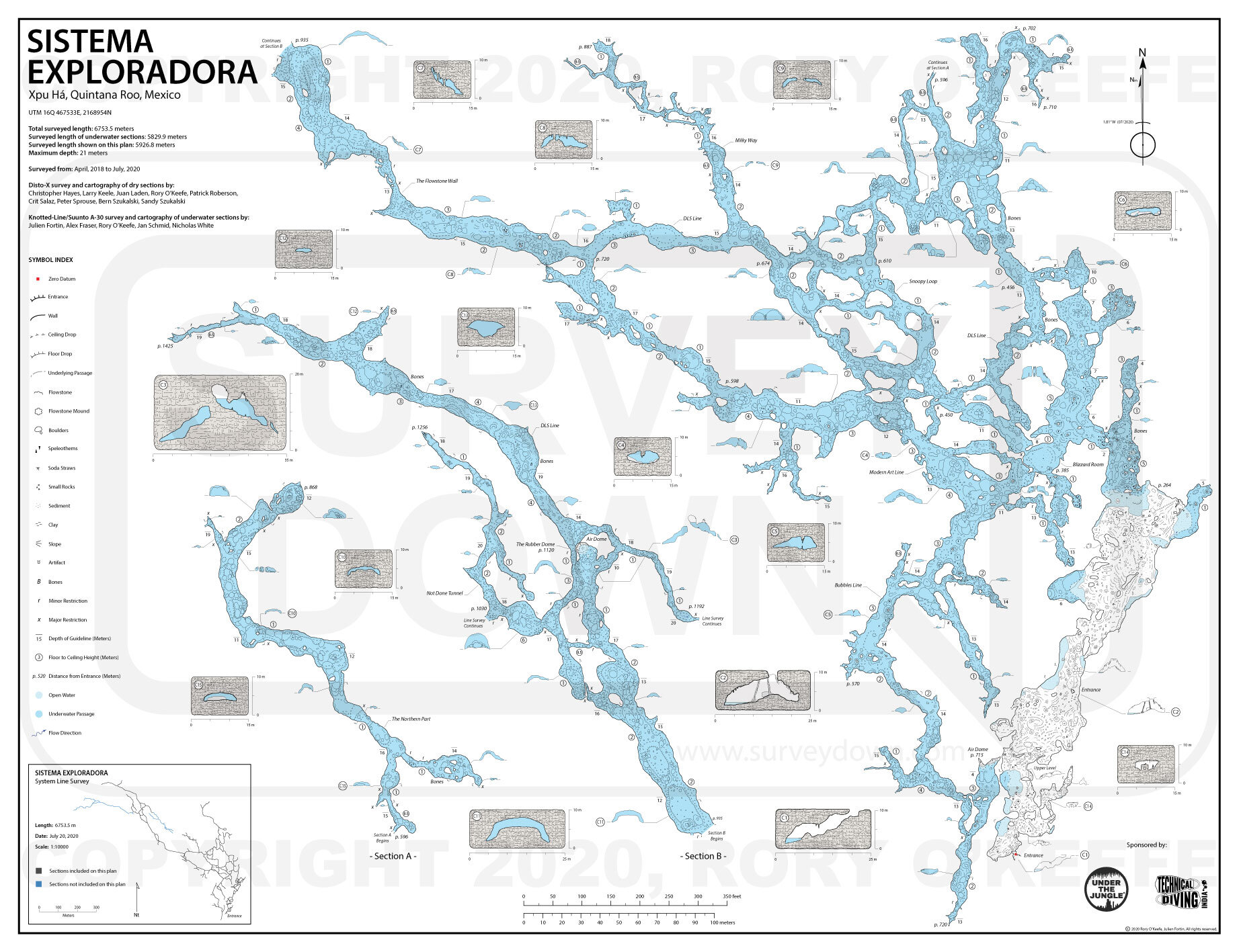
Cave Cartography, Mapping the Hidden Worlds Beneath Our Feet
Read More: Cave Cartography, Mapping the Hidden Worlds Beneath Our FeetWhile satellites chart the skies and oceans, one of Earth’s last frontiers remains underground—caves. Cave cartography, the detailed mapping of subterranean passages, is both…