Category: Exploration & Discovery
-

Deep Sea Exploration, Unveiling the Mysteries of the Abyss
Read More: Deep Sea Exploration, Unveiling the Mysteries of the Abyssalongxp.com – The deep sea—defined as ocean depths below 200 meters where sunlight barely penetrates—covers more than 60% of Earth’s surface yet remains one…
-
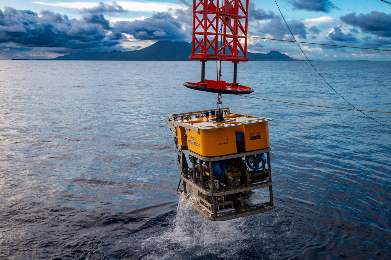
Karambusel Hydrothermal Field: A New Frontier in Deep-Sea Exploration
Read More: Karambusel Hydrothermal Field: A New Frontier in Deep-Sea ExplorationIn a recent expedition off the coast of Papua New Guinea, scientists discovered a strikingly unique deep-sea environment known as the Karambusel hydrothermal field.…
-

Into the Depths, Cutting-Edge Discoveries and Tech in Underwater Cave Exploration
Read More: Into the Depths, Cutting-Edge Discoveries and Tech in Underwater Cave ExplorationUnderwater caves are rapidly emerging as frontiers not just for adventure, but scientific discovery. Recent research has uncovered startling biodiversity in submarine caves around…
-
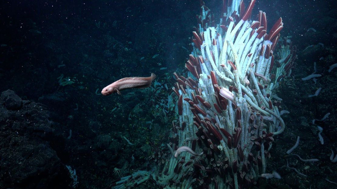
Charting Deep Sea Vents: Uncovering Life in Earth’s Darkest Depths
Read More: Charting Deep Sea Vents: Uncovering Life in Earth’s Darkest DepthsThe discovery of deep-sea hydrothermal vents has transformed our understanding of life’s boundaries, pushing the limits of exploration into some of Earth’s most extreme…
-
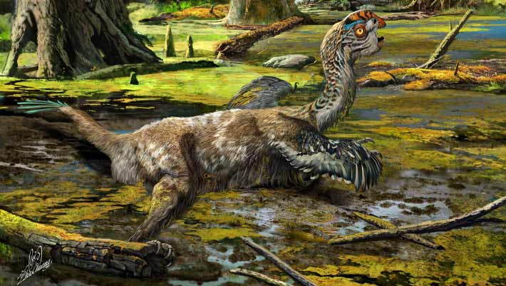
Tongtianlong Fossil Site, A Jurassic Gem in China
Read More: Tongtianlong Fossil Site, A Jurassic Gem in Chinaalongxp.com – In July 2025, paleontologists unveiled Tongnanlong zhimingi, a massive 90-foot sauropod from the Late Jurassic, at the Tongnanlong Fossil Site in Chongqing,…
-
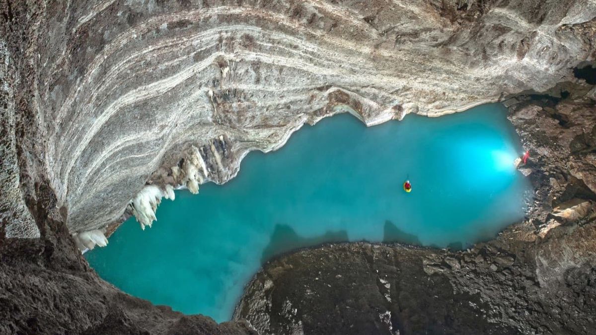
Lake Neuron, Inside the World’s Largest Underground Thermal Lake Discovered Beneath Albania
Read More: Lake Neuron, Inside the World’s Largest Underground Thermal Lake Discovered Beneath AlbaniaCzech speleologists recently uncovered Lake Neuron, the world’s largest known underground thermal lake, hidden 127 meters beneath the surface in the Vromoneri Valley near Leskovik, Albania.…
-
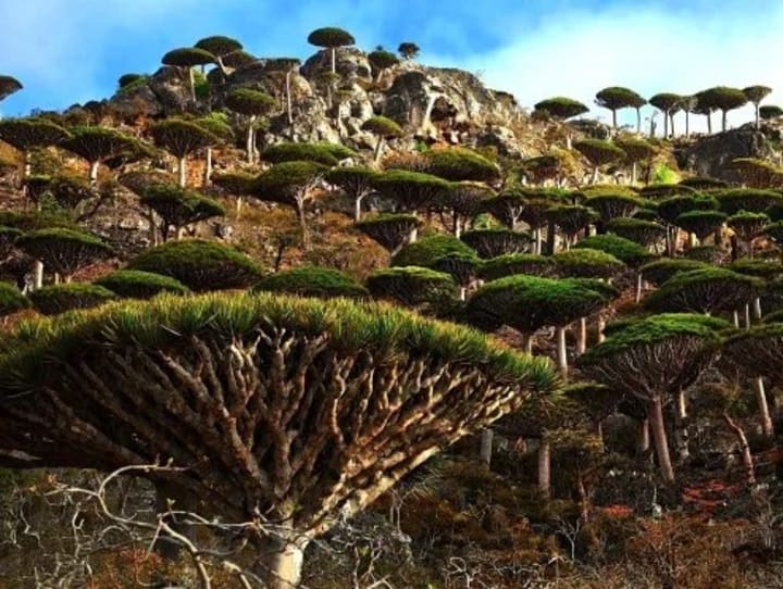
Socotra, The Alien Island Few Travelers Know Exists
Read More: Socotra, The Alien Island Few Travelers Know ExistsTucked away in the Arabian Sea, Socotra Island is one of the most otherworldly places on Earth—yet it remains unknown to many. Often called…
-
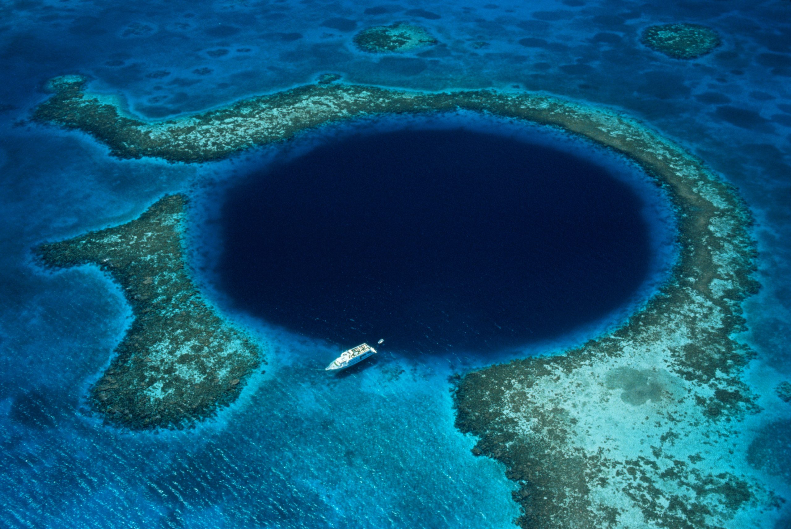
The Enigmatic Blue Holes of Saudi Arabia: Hidden Wonders Beneath the Red Sea
Read More: The Enigmatic Blue Holes of Saudi Arabia: Hidden Wonders Beneath the Red SeaTucked along Saudi Arabia’s Red Sea coast lies a breathtaking underwater labyrinth: the recently revealed Blue Holes, a series of roughly twenty marine caverns…
-
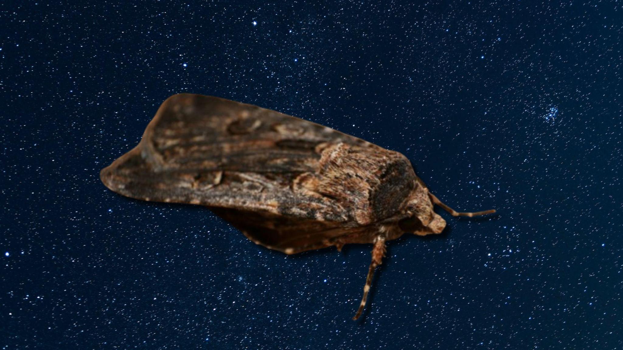
The Bogong Moth’s Night-Sky Navigation: Celestial Compass in an Insect
Read More: The Bogong Moth’s Night-Sky Navigation: Celestial Compass in an InsectA recent Nature study has unveiled that the Australian Bogong moth (Agrotis infusa) uses celestial cues—specifically star patterns—as it migrates roughly 1,000 km from the…
-
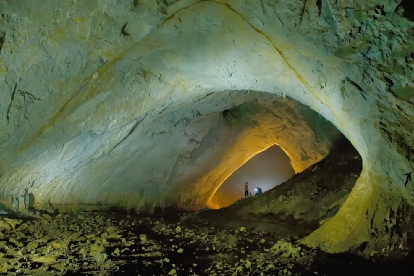
Exploring the Movile Cave: Life Thriving Without Sunlight for 5.5 Million Years
Read More: Exploring the Movile Cave: Life Thriving Without Sunlight for 5.5 Million YearsDiscovered in 1986 beneath a plain in Romania, the Movile Cave is one of the most alien environments on Earth—a sealed ecosystem where life…